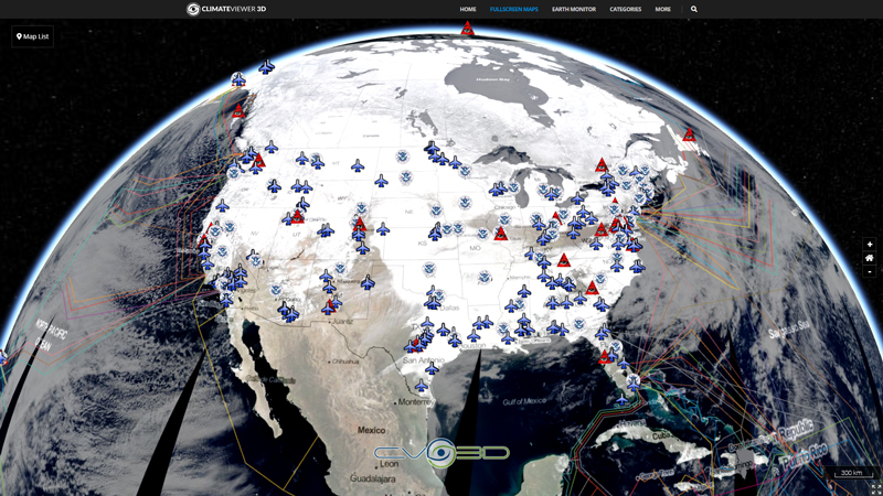
Joint Surveillance System (JSS)
The JSS is a joint United States Air Force and Federal Aviation Administration system for the atmospheric air defense of North America. It replaced the Semi Automatic Ground Environment (SAGE) system in 1983.
The JSS consists of long range surveillance radars, primarily operated and maintained by the Federal Aviation Administration (FAA), but providing communication and radar data to both FAA and United States Air Force control centers.
Air Route Surveillance Radar (ARSR)
FAA equipment is a primarily a mixture of Long Range Air Route Surveillance Radars (ARSR) of various types, although some use legacy AN/FPS radars. They are co-located with UHF ground-air-ground (G/A/G) transmitter/receiver (GATR) facilities at many locations. Fourteen sites have VHF radios as well. The GATR facility provides radio access to fighters and Airborne early warning and control (AEW&C) aircraft from the SOCCs. The JSS has been enhanced under the FAA/Air Force Radar Replacement Program with 44 ARSR-4/FPS-130 radars to replace some of the many previous long-range radars. This provides common, high-performance, unattended radars. The ARSR-4/FPS-130 is a 3-D long range radar with an effective detection range of some 250 miles and has been fully integrated with JSS at all joint use sites.
These radars are generally unattended except for periodic FAA maintenance crews which visit the sites as necessary.
Source: Joint Surveillance System, Wikipedia
Tags
Map Type
GeoJSON
Map Source
More Info
https://fas.org/nuke/guide/usa/airdef/arsr-4.htm
Attribution
Jim Lee, ClimateViewer NewsMap: Joint Surveillance System (JSS) Air Route Surveillance Radar (ARSR-4) by Jim Lee is licensed under a Creative Commons Attribution-NonCommercial-ShareAlike 4.0 International License. Based on a work at climateviewer.org/. Permissions beyond the scope of this license may be available at climateviewer.com/terms.
 You are free to:
- Share — copy and redistribute the material in any medium or format
- Adapt — remix, transform, and build upon the material
- Attribution — You must give appropriate credit, provide a link to the license, and indicate if changes were made. You may do so in any reasonable manner, but not in any way that suggests the licensor endorses you or your use.
- NonCommercial — You may not use the material for commercial purposes.
- ShareAlike — If you remix, transform, or build upon the material, you must distribute your contributions under the same license as the original.


Leave Us A Comment