Big Brother Is Watching!
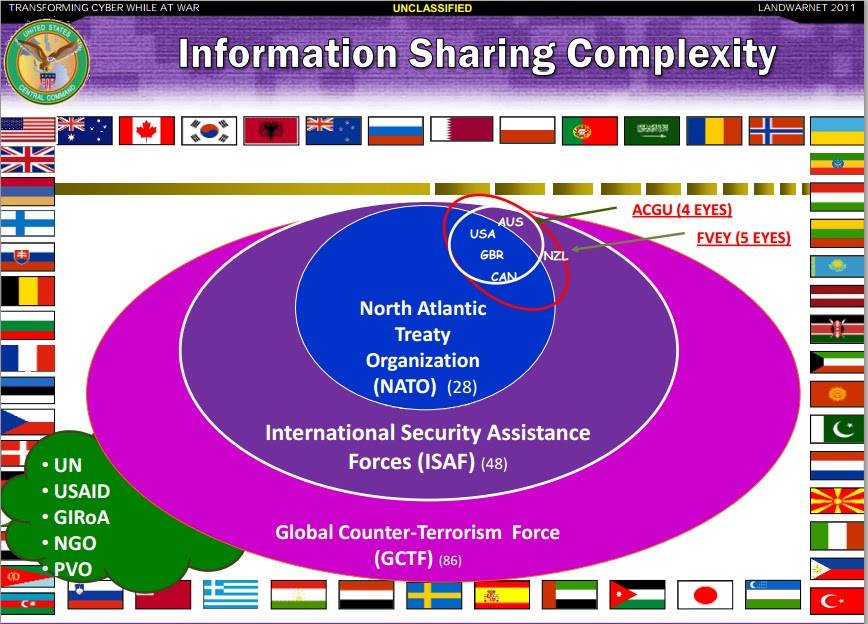
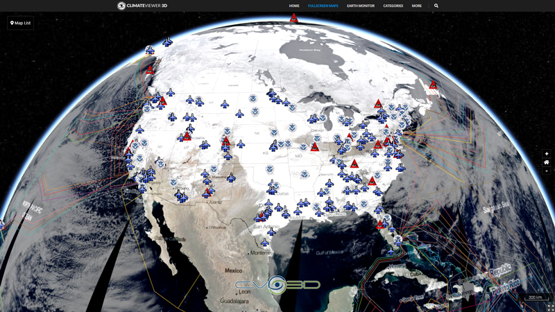
This map covers government surveillance facilities, signals intelligence networks (SIGINT), AUSCANNZUKUS, and The Five Eyes of the New World Order.
War leads to the erosion of liberty for the benefit of the military-industrial complex. World War II set in motion the destruction of privacy and the formation of an Orwellian Police State controlled by the National Security Agency (NSA) of the United States of America. Under the guise of cooperation and mutual respect, countries signed secret agreements with the NSA to share signals intelligence (SIGINT) which in layman’s terms means your phone calls, instant messages, and more. Shortly after World War II, the United States and its allies built the ECHELON system to spy on land and satellite-based communications worldwide. Their closest allies, dubbed The Five Eyes (FVEY), received privileged treatment from the NSA community wherein these five countries share resources on a grand scale. The Five Eyes are also know as AUSCANNZUKUS, short for AUStralia, CANada, New Zealand, UK, and US. As time progressed the Five Eyes added two more tiers to their club: the Nine Eyes and Fourteen Eyes. The Fourteen Eyes are officially known as SIGINT Seniors Europe, or “SSEUR” but I think we can unofficially call them: The New World Order.
5 Eyes
Australia
Canada
New Zealand
United Kingdom
United States
9 Eyes
Denmark
France
the Netherlands
Norway
14 Eyes
Germany
Belgium
Italy
Spain
Sweden
Tags
Map Type
GeoJSON
Map Source
https://climateviewer.org/layers/geojson/2018/Five-Eyes-ClimateViewer-3D.geojson
More Info
https://climateviewer.com/privacy/
Attribution
Jim Lee, ClimateViewer NewsMap: Five Eyes STONEGHOST Surveillance Network by Jim Lee is licensed under a Creative Commons Attribution-NonCommercial-ShareAlike 4.0 International License. Based on a work at climateviewer.org/. Permissions beyond the scope of this license may be available at climateviewer.com/terms.
 You are free to:
- Share — copy and redistribute the material in any medium or format
- Adapt — remix, transform, and build upon the material
- Attribution — You must give appropriate credit, provide a link to the license, and indicate if changes were made. You may do so in any reasonable manner, but not in any way that suggests the licensor endorses you or your use.
- NonCommercial — You may not use the material for commercial purposes.
- ShareAlike — If you remix, transform, or build upon the material, you must distribute your contributions under the same license as the original.


Leave Us A Comment