
Alpha RSDN-20, Beta Time Signal, LORAN-C, AWESOME VLF Network, Ground Wave Emergency Network (GWEN), and ELF transmission facilities.
Alpha, Beta, and LORAN-C
Alpha (also called RSDN-20 ) is a Russian system for long range radio navigation. It operates on the frequencies: 11904.76190, 12648.80952, 14880.95238, 14881.09127, 12090.77381, 12044.27083 Hz.
Beta Time Signal broadcasting on 20.50, 23.00, 25.00, 25.10, and 25.50 kHz.
LORAN (LOng RAnge Navigation) is a terrestrial navigation system using low frequency radio transmitters that use the time interval between radio signals received from three or more stations to determine the position of a ship or aircraft. The current version of LORAN in common use is LORAN-C, which operates in the low frequency portion of the EM spectrum from 90 to 110 kHz.
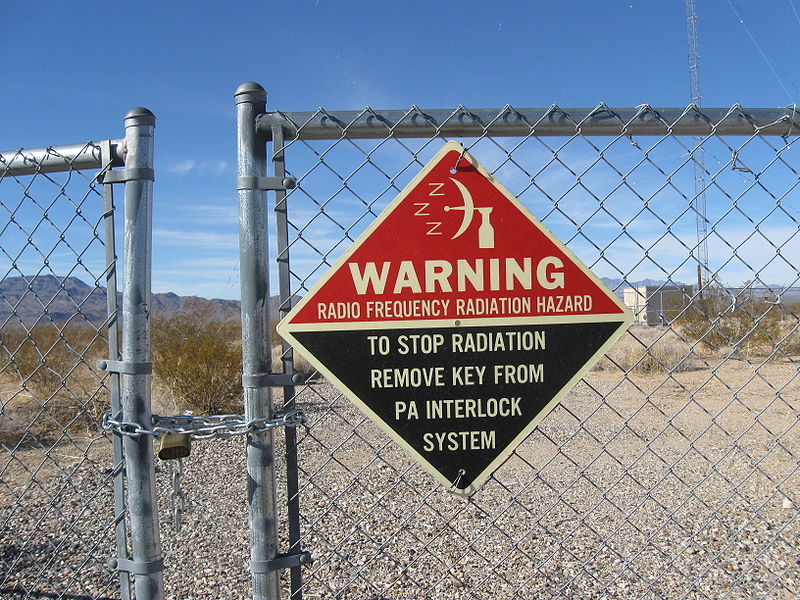
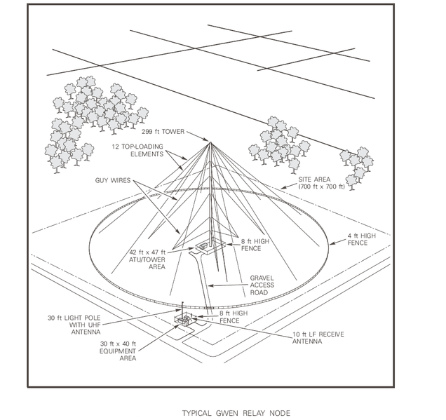
The Ground Wave Emergency Network (GWEN)
The Ground Wave Emergency Network (GWEN) was a command and control communications system intended for use by the United States government to facilitate military communications before, during and after a nuclear war. Specifically, GWEN was constructed to survive the effects of a high-altitude nuclear explosion electromagnetic pulse to insure that the United States President or his survivors can give a launching order to strategic nuclear bombers.
GWEN was part of the Strategic Modernization Program designed to upgrade the nation’s strategic communication system, thereby strengthening the value of nuclear deterrence. The GWEN communication system, established in the late 1980s, was designed to transmit critical messages (i.e. Emergency Action Messages (EAMs)) to United States nuclear forces. EMP, over a large area, can produce a sudden power surge that would overload unprotected electronic equipment and render it inoperable. In addition, EMP would interfere with transmissions that use the ionosphere for propagation. GWEN would use a ground-hugging wave for propagation, being unaffected by the EMP.
The network was conceived as an array of approximately 300 radio transceivers distributed across the continental USA which operated in the Low Frequency (LF) radio band. Later revised for 126 towers, plans again changed to include 56 radio towers linking 38 terminals; it was later expanded to 96 towers linking 49 terminals. Final network towers numbered 58. Source: Wikipedia
Assessment of the Possible Health Effects of Ground Wave Emergency Network (1993)
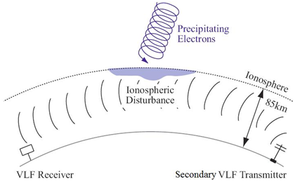
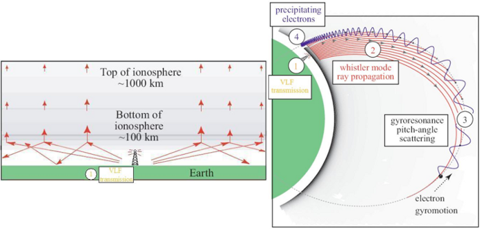
AWESOME Space Weather Monitoring System
A tmospheric
   W eather
      E lectromagnetic
        S ystem for
          O bservation
             M odeling and
               E ducation
Tags
Map Type
GeoJSON
Map Source
More Info
https://climateviewer.com/space-weather-modification/
Attribution
Jim Lee, ClimateViewer NewsMap: Extremely Low Frequency (ELF, ULF, VLF) Transmission Sites by Jim Lee is licensed under a Creative Commons Attribution-NonCommercial-ShareAlike 4.0 International License. Based on a work at climateviewer.org/. Permissions beyond the scope of this license may be available at climateviewer.com/terms.
 You are free to:
- Share — copy and redistribute the material in any medium or format
- Adapt — remix, transform, and build upon the material
- Attribution — You must give appropriate credit, provide a link to the license, and indicate if changes were made. You may do so in any reasonable manner, but not in any way that suggests the licensor endorses you or your use.
- NonCommercial — You may not use the material for commercial purposes.
- ShareAlike — If you remix, transform, or build upon the material, you must distribute your contributions under the same license as the original.
Jim Lee • Creator of ClimateViewer Maps

I am forever a Boy Scout, lifetime artist, nocturnal programmer, music is my life, love is my religion, and I am the luckiest husband and father on Earth. I speak for the trees. I have a passion for mapping, magnets, and mysteries. Feel free to contact me: jim@climateviewer.com