
This documentary, in the form of a satellite map, applies geography to the 100+ year old Köppen Climate Classification System. The intent of this map is to be a visual glossary of climate classifications. With it you will be able to see the actual geography that affects climate and how the geography is affected by the climate. I was very surprised that no one had ever done this before.
If you combine this map with other weather related maps on this site you can see how today’s weather matches up with the local climate classifications assigned over 100 years ago. For example, if you combine this Köppen Climate Classification System map with the 24-hour Rainfall Forecast map, you get the following result shown below.
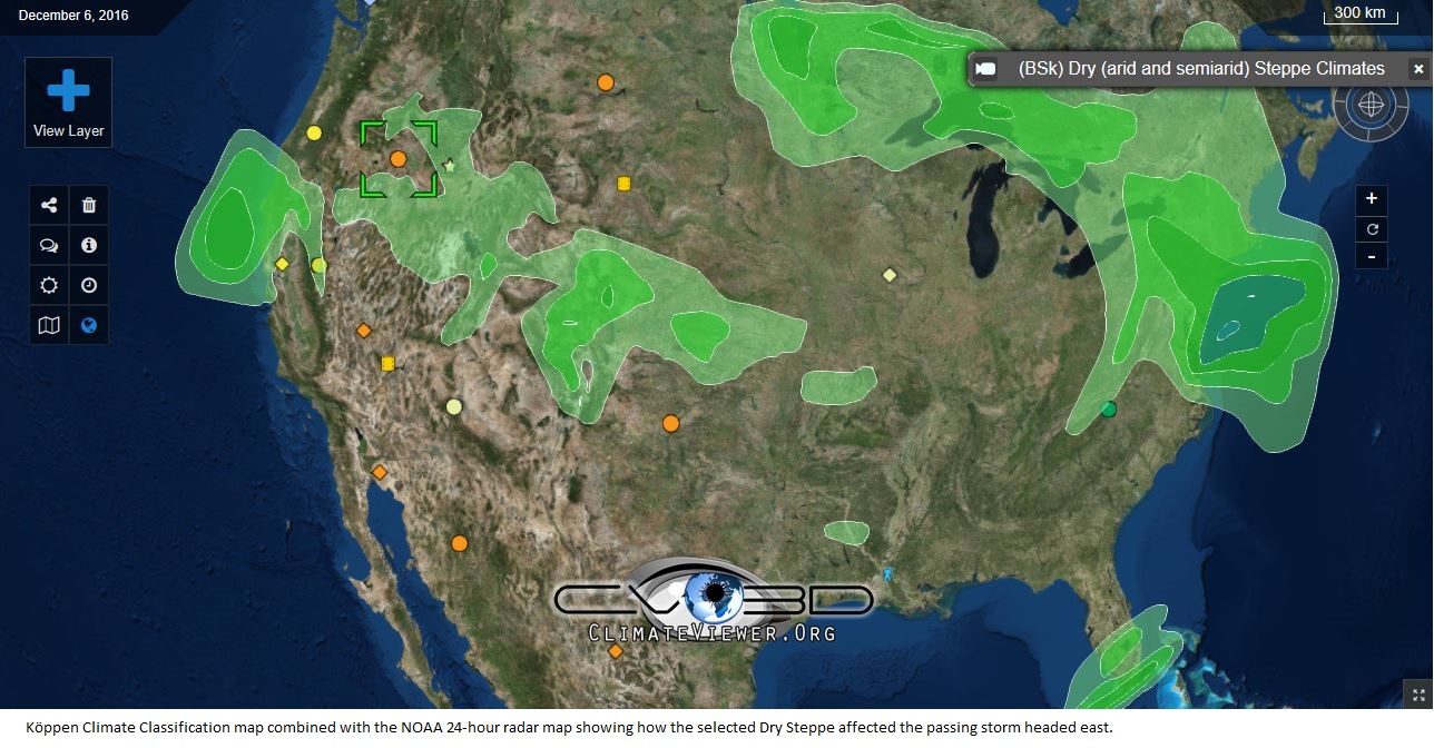
Note the highlighted orange dot over the northwest which has eastward bound precipitation surrounding it. Did the (BSh) Dry (arid and semiarid) Steppe affect the weather as much as the weather affected the biome?
Another example, if you combine this Köppen Climate Classification System map with the Infrared 0.39 - 41.5 Degree map, you get the following result show below. Note how the clouds are passing east to west in Africa along the edge of the orange (BSh) Dry (arid and semiarid) Steppe and that the blue (Aw) Tropical (wet and dry or savanna) are where the storms are.
.svg)
Tags
Map Type
Keyhole Markup Language (Google Earth KML)
Map Source
Attribution
George Stiller, MyReadingMapped™Map: Geography of the Köppen Climate Classification System by George Stiller and Jim Lee is licensed under a Creative Commons Attribution-NonCommercial-ShareAlike 4.0 International License. Based on a work at climateviewer.org/. Permissions beyond the scope of this license may be available at climateviewer.com/terms.
 You are free to:
- Share — copy and redistribute the material in any medium or format
- Adapt — remix, transform, and build upon the material
- Attribution — You must give appropriate credit, provide a link to the license, and indicate if changes were made. You may do so in any reasonable manner, but not in any way that suggests the licensor endorses you or your use.
- NonCommercial — You may not use the material for commercial purposes.
- ShareAlike — If you remix, transform, or build upon the material, you must distribute your contributions under the same license as the original.
Jim Lee • Creator of ClimateViewer Maps

I am forever a Boy Scout, lifetime artist, nocturnal programmer, music is my life, love is my religion, and I am the luckiest husband and father on Earth. I speak for the trees. I have a passion for mapping, magnets, and mysteries. Feel free to contact me: jim@climateviewer.com