
This section contains maps created by George Stiller of MyReadingMapped™ and Jim Lee of ClimateViewer News.
The following documentaries, in the form of satellite maps, cover almost 100 years of aviation crash sites, 184 years of train wrecks and the spread of railroads, flights, and shipping worldwide, that you can zoom in close on and enable you to digitally experience the event.
Map List
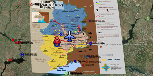
Malaysian Airlines MH17 shot down by SA-11 (2014)
Malaysia Airlines flight 17, also called Malaysia Airlines flight MH17, flight of a passenger airliner that crashed and burned in eastern Ukraine on July 17, 2014. All 298 people on board, most of who...
View Map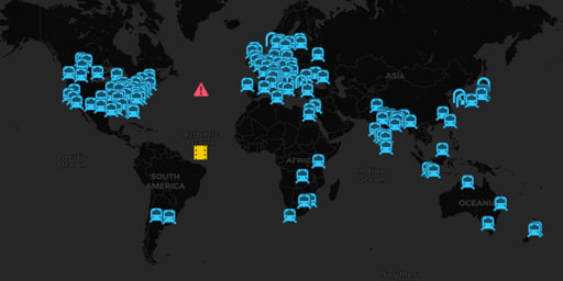
Great Train Wrecks (2010-2014)
In this documentary, in the form of a satellite map, is part of a series of maps on this site that trace the history of rail accidents worldwide and the growth of railroads. In this map you can trace ...
View Map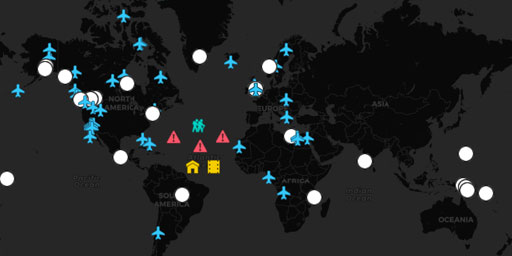
Plane Wrecks Seen by Satellite
This satellite map has over 50 actual plane wrecks you can see when you zoom in very close and another 25 that have been geo-tagged as existing at the plotted location. They include commercial airline...
View Map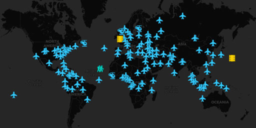
Commercial Aviation Crashes (2001-2010)
In this documentary, in the form of a satellite map, is the 6th of a 7–part series of maps covering the growth of commercial aviation worldwide. With this map you can zoom in on the locations of the c...
View Map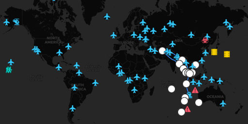
Commercial Aviation Crashes (2011-2013)
In this documentary, in the form of a satellite map, is the 6th of a 7–part series of maps covering the growth of commercial aviation worldwide. With this map you can zoom in on the locations of the c...
View Map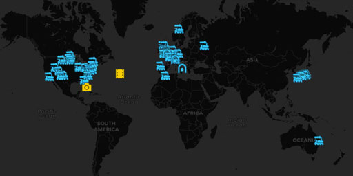
Great Train Wrecks (1930-1949)
In this documentary, in the form of a satellite map, is part of a series of maps on this site that trace the history of rail accidents worldwide and the growth of railroads. In this map you can trace ...
View Map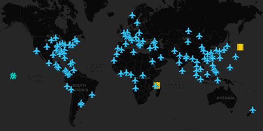
Commercial Aviation Crashes (1991-2000)
In this documentary, in the form of a satellite map, is the 5th of a 7–part series of maps covering the growth of commercial aviation worldwide. With this map you can in on the locations of the commer...
View Map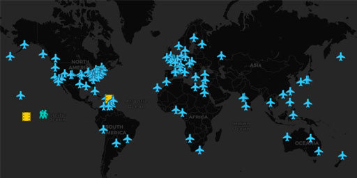
Commercial Aviation Crashes (1961-1970)
In this documentary, in the form of a satellite map, is the 2nd of a 7–part series of maps covering the growth of commercial aviation worldwide. With this map you can zoom in on the locations of the c...
View Map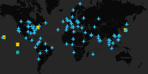
Commercial Aviation Crashes (1981-1990)
In this documentary, in the form of a satellite map, is the 4th of a 7–part series of maps covering the growth of commercial aviation worldwide. With this map you can zoom in on the locations of the C...
View Map
Great Train Wrecks (1830-1930)
In this documentary, in the form of a satellite map, you can trace 100 years of railroad history from 1830 up to 1930. You can follow the location of Casey Jones’ last train before he died, and ...
View Map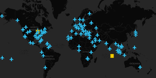
Commercial Aviation Crashes (1971-1980)
In this documentary, in the form of a satellite map, is the 3rd of a 7–part series of maps covering the growth of commercial aviation worldwide. With this map you can zoom in on the locations of the C...
View Map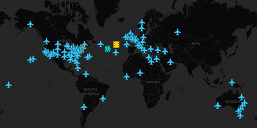
Commercial Propeller-Driven Airplane Crashes (1920-1960)
This documentary, in the form of a satellite map, is the 1st of a 7–part series of maps covering the growth of commercial aviation worldwide. With this map you can locate the historic commercial aircr...
View Map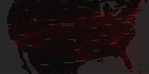
Flight Routes in the USA
The Next Generation Air Transportation System, or NextGen, is the FAA-led modernization of America’s air transportation system to make flying even safer, more efficient, and more predictable. Ne...
View Map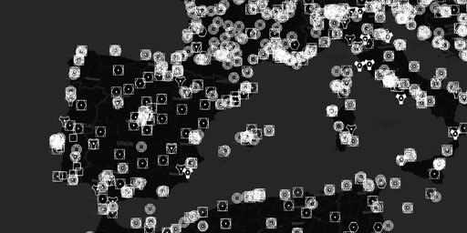
ICAO Flight Navigation Aids (VOR/NDB)
The Tiny Flight Tracker/Viewer (TFTV) is a program that permits, via the FSUIPC (FS9,FSX,P3D) or XPUIPC (X-plane) modules, an automated, simple and precise recording of many relevant flight parameters...
View Map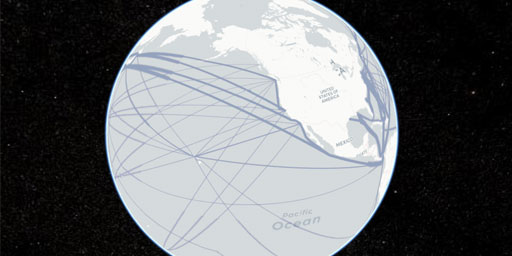
International Ship Routes
Based on vectors from the “Map of the World Oceans, October 2012”, published by the CIA.
View Map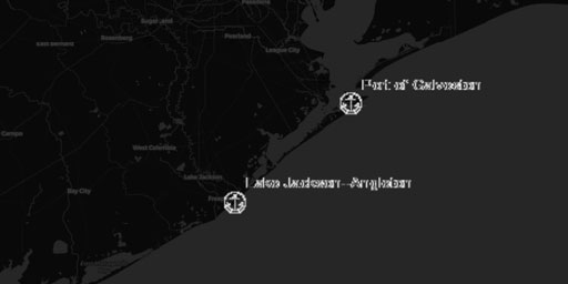
U.S. Ports
This nowCOAST™ map service provides maps depicting the locations of ports in the United States of America. The map service is updated when we become aware of changes to the source data sets.
View Map
World Major Airport Runways
This nowCOAST™ map service provides maps depicting the locations of major world airport runways. The map service is updated when we become aware of changes to the source data sets.
View MapJim Lee • Creator of ClimateViewer Maps

I am forever a Boy Scout, lifetime artist, nocturnal programmer, music is my life, love is my religion, and I am the luckiest husband and father on Earth. I speak for the trees. I have a passion for mapping, magnets, and mysteries. Feel free to contact me: jim@climateviewer.com