
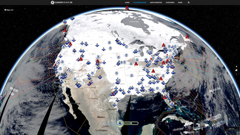
Map Apps
Pages on ClimateViewer Maps
Map Sections
Alerts and Weather Map Section
Air Quality
- Air Quality Index (Current)
- Air Quality Index (Today)
- Air Quality Index (Tomorrow)
- Air Quality Index (Yesterday)
Earthquakes
- Euro-Med Earthquakes - CSEM/EMSC
- NOAA Ocean Buoys
- USGS - All Earthquakes (Last Hour)
- USGS - All Earthquakes (Today)
- USGS - M1.0+ Earthquakes (Last Week)
- USGS - M2.5+ Earthquakes (Last Month)
- USGS - M2.5+ Earthquakes (Last Week)
- USGS - M2.5+ Earthquakes (Today)
- USGS - M4.5+ Earthquakes (Last Month)
- USGS - M4.5+ Earthquakes (Last Week)
- USGS - M4.5+ Earthquakes (Today)
- USGS - Tectonic Plate Boundaries
- The Topography of Plate Tectonics
Fire and Volcanoes
Hurricane and Tropical Storms
- Tropical Cyclone Current Wind Extent
- Tropical Cyclone Observed Center Positions
- Tropical Cyclone Observed Surface Wind Swath
- Tropical Cyclone Observed Track Line
- Tropical Cyclone Track Line Forecasts
- Tropical Storm Tracking (U.S. Naval Oceanography Portal)
Lightning
Rain and Snow
- Rainfall Atlantic Ocean - MET0D
- Rainfall Indian Ocean - IODC
- U.S. Drought Monitor
- U.S. Rainfall - 24 Hour Forecast
- U.S. Rainfall - 5 Day Forecast
- U.S. Rainfall - 6 Hour Forecast
- U.S. Rainfall - Multi-Radar/Multi-Sensor (MRMS) System NEXRAD Weather Radar
- U.S. Rainfall - NEXRAD Radar, Base Reflectivity
- U.S. River Flood Levels
- U.S. River Gauges
- U.S. Significant Flood Risk
- U.S. Snow Depth
- U.S. Snow Water Equivalent
- AMSR2 GCOM-W1 - Surface Precipitation Rate (Day)
- AMSR2 GCOM-W1 - Surface Precipitation Rate (Night)
- AMSR2 GCOM-W1 - Surface Rain Rate (Day)
- AMSR2 GCOM-W1 - Surface Rain Rate (Night)
- IMERG - Rain Rate (Early)
- IMERG - Snow Rate (Early)
- Multi-Sensor Precipitation Estimate - 0 Degree
- Multi-Sensor Precipitation Estimate - 41.5 Degree
Watches and Warnings
Wind
Satellite Imagery Map Section
CIMSS MIMIC
- Dvorak BD Enhancement - Infrared - Europe & Africa
- Dvorak BD Enhancement - Infrared - Indian Ocean
- Dvorak BD Enhancement - Infrared - North Atlantic
- Dvorak BD Enhancement - Infrared - Northeast Pacific
- Dvorak BD Enhancement - Infrared - Northwest Pacific
- Dvorak BD Enhancement - Infrared - Western Australia
- NHC Enhancement - Infrared - Europe & Africa
- NHC Enhancement - Infrared - Indian Ocean
- NHC Enhancement - Infrared - North Atlantic
- NHC Enhancement - Infrared - Northeast Pacific
- NHC Enhancement - Infrared - Northwest Pacific
- NHC Enhancement - Infrared - Western Australia
- Total Precipitable Water - Indian Ocean
- Total Precipitable Water - North Atlantic
- Total Precipitable Water - Northeast Pacific
- Total Precipitable Water - Northwest Pacific
- Total Precipitable Water - Version 2 - Indian Ocean
- Total Precipitable Water - Version 2 - North Atlantic
- Total Precipitable Water - Version 2 - Northeast Pacific
- Total Precipitable Water - Version 2 - Northwest Pacific
- Unenhanced - Infrared - Europe & Africa
- Unenhanced - Infrared - Indian Ocean
- Unenhanced - Infrared - North Atlantic
- Unenhanced - Infrared - Northeast Pacific
- Unenhanced - Infrared - Northwest Pacific
- Unenhanced - Infrared - Western Australia
- Unenhanced - Water Vapor - Europe & Africa
- Unenhanced - Water Vapor - Indian Ocean
- Unenhanced - Water Vapor - North Atlantic
- Unenhanced - Water Vapor - Northeast Pacific
- Unenhanced - Water Vapor - Northwest Pacific
- Unenhanced - Water Vapor - Western Australia
GOES Satellite Section
- Global Visible Imagery Mosaic
- Global Longwave Infrared Mosaic
- Global Shortwave Infrared Mosaic
- Northern Hemisphere Longwave Infrared Composite
- Northern Hemisphere Shortwave Infrared Composite
- Northern Hemisphere Visible Imagery Composite
- Northern Hemisphere Water Vapor Imagery Composite
EUMETSAT
- Airmass - 0 Degree
- Airmass - 41.5 Degree
- Cloud Analysis - 0 Degree
- Cloud Analysis - 41.5 Degree
- Cloud Mask - 0 Degree
- Cloud Mask - 41.5 Degree
- Cloud Top Height - 0 Degree
- Cloud Top Height - 41.5 Degree
- Convection - 0 Degree
- Convection - 41.5 Degree
- Day Microphysics - 0 Degree
- Day Microphysics - 41.5 Degree
- Dust - 0 Degree
- Dust - 41.5 Degree
- European HRV (E-View) - 0 Degree
- European HRV (E-View) - 41.5 Degree
- Fog & Low Clouds - 0 Degree
- Fog & Low Clouds - 41.5 Degree
- Infrared 0.39 - 0 Degree
- Infrared 0.39 - 41.5 Degree
- Infrared 10.8 - 0 Degree
- Infrared 10.8 - 41.5 Degree
- Multi-Sensor Precipitation Estimate - 0 Degree
- Multi-Sensor Precipitation Estimate - 41.5 Degree
- Natural Color - 0 Degree
- Natural Color - 41.5 Degree
- Snow - 0 Degree
- Snow - 41.5 Degree
- Visual - 0 Degree
- Visual - 41.5 Degree
- Volcanic Ash - 0 Degree
- Volcanic Ash - 41.5 Degree
- Water Vapor - 0 Degree
- Water Vapor - 41.5 Degree
US Naval Research Lab
NASA Aerosol Optical Depth
- NASA MODIS Aqua - Aerosol Optical Depth
- NASA MODIS Aqua - Aerosol Optical Depth (3km, Land and Ocean)
- NASA MODIS Aqua - Dark Target Aerosol Angstrom Exponent (Ocean)
- NASA MODIS Aqua - Deep Blue Aerosol Angstrom Exponent (Land)
- NASA MODIS Aqua - Deep Blue Aerosol Optical Depth (Land)
- NASA MODIS Aqua - Merged Dark Target/Deep Blue (DT/DB) Aerosol Optical Depth (Land and Ocean)
- NASA MODIS Terra & Aqua - Combined Value-Added Aerosol Optical Depth
- NASA MODIS Terra - Aerosol Optical Depth
- NASA MODIS Terra - Aerosol Optical Depth 3 km (3km, Land and Ocean)
- NASA MODIS Terra - Dark Target Aerosol Angstrom Exponent (Ocean)
- NASA MODIS Terra - Deep Blue Aerosol Angstrom Exponent (Land)
- NASA MODIS Terra - Deep Blue Aerosol Optical Depth (Land)
- NASA MODIS Terra - Merged Dark Target/Deep Blue (DT/DB) Aerosol Optical Depth (Land and Ocean)
- NASA OMI Aura - Aerosol Index
- NASA OMI Aura - Aerosol Optical Depth (Extinction, Near-UV, 388.0 nm)
- NASA OMPS Suomi-NPP - Aerosol Index
NASA Atmospheric Gases
- NASA AIRS Aqua - Carbon Monoxide (CO) Total Column (Day)
- NASA AIRS Aqua - Carbon Monoxide (CO) Total Column (Night)
- NASA AIRS Aqua - Sulfur Dioxide (SO2) Index (Day)
- NASA AIRS Aqua - Sulfur Dioxide (SO2) Index (Night)
- NASA MLS Aura - Carbon Monoxide (CO) at 215 hPa (Day)
- NASA MLS Aura - Carbon Monoxide (CO) at 215 hPa (Night)
- NASA MLS Aura - Nitric Acid (HNO3) at 46 hPa (Day)
- NASA MLS Aura - Nitric Acid (HNO3) at 46 hPa (Night)
- NASA MLS Aura - Nitrous Oxide (N2O) at 46 hPa (Day)
- NASA MLS Aura - Nitrous Oxide (N2O) at 46 hPa (Night)
- NASA MLS Aura - Ozone (O3) at 46 hPa (Day)
- NASA MLS Aura - Ozone (O3) at 46 hPa (Night)
- NASA MLS Aura - Sulfur Dioxide (SO2) at 147 hPa (Day)
- NASA MLS Aura - Sulfur Dioxide (SO2) at 147 hPa (Night)
- NASA MOPITT Terra - Carbon Monoxide (Daily, Day, Total Column)
- NASA MOPITT Terra - Carbon Monoxide (Daily, Night, Surface Mixing Ratio)
- NASA MOPITT Terra - Carbon Monoxide (Daily, Night, Total Column)
- NASA MOPITT Terra - Carbon Monoxide (L2, Day/Night, Total Column)
- NASA MOPITT Terra - Carbon Monoxide (Monthly, Day, Total Column)
- NASA MOPITT Terra - Carbon Monoxide (Monthly, Night Surface Mixing Ratio)
- NASA MOPITT Terra - Carbon Monoxide (Monthly, Night, Total Column)
- NASA OMPS Suomi-NPP - Ozone
- NASA OMPS Suomi-NPP - Sulfur Dioxide (Lower Troposphere)
- NASA OMPS Suomi-NPP - Sulfur Dioxide (Middle Troposphere)
- NASA OMPS Suomi-NPP - Sulfur Dioxide (Planetary Boundary Layer)
- NASA OMPS Suomi-NPP - Sulfur Dioxide (Upper Troposphere and Stratosphere)
NASA Brightness Temperature
- NASA GPM GMI - Brightness Temperature (Ascending)
- NASA GPM GMI - Brightness Temperature (Descending)
- NASA MLS Aura - Temperature at 46 hPa (Day)
- NASA MLS Aura - Temperature at 46 hPa (Night)
- NASA MODIS Aqua - Brightness Temperature (Band 31, day)
- NASA MODIS Aqua - Brightness Temperature (Band 31, night)
- NASA MODIS Terra - Brightness Temperature (Band 31, day)
- NASA MODIS Terra - Brightness Temperature (Band 31, night)
- NASA SMAP Radiometer - Uncorrected Brightness Temperature (L1, Passive Enhanced, Aft, H Polarization)
- NASA SMAP Radiometer - Uncorrected Brightness Temperature (L1, Passive Enhanced, Aft, V Polarization)
- NASA SMAP Radiometer - Uncorrected Brightness Temperature (L1, Passive Enhanced, Fore, H Polarization)
- NASA SMAP Radiometer - Uncorrected Brightness Temperature (L1, Passive Enhanced, Fore, V Polarization)
- NASA SMAP Radiometer - Uncorrected Brightness Temperature (L1, Passive, Aft, H Polarization)
- NASA SMAP Radiometer - Uncorrected Brightness Temperature (L1, Passive, Aft, V Polarization)
- NASA SMAP Radiometer - Uncorrected Brightness Temperature (L1, Passive, Fore, H Polarization)
- NASA SMAP Radiometer - Uncorrected Brightness Temperature (L1, Passive, Fore, V Polarization)
- NASA SMAP Radiometer - Uncorrected Brightness Temperature QA (L1, Passive Enhanced, Aft, H Polarization)
- NASA SMAP Radiometer - Uncorrected Brightness Temperature QA (L1, Passive Enhanced, Aft, V Polarization)
- NASA SMAP Radiometer - Uncorrected Brightness Temperature QA (L1, Passive Enhanced, Fore, H Polarization)
- NASA SMAP Radiometer - Uncorrected Brightness Temperature QA (L1, Passive Enhanced, Fore, V Polarization)
- NASA SMAP Radiometer - Uncorrected Brightness Temperature QA (L1, Passive, Aft, H Polarization)
- NASA SMAP Radiometer - Uncorrected Brightness Temperature QA (L1, Passive, Aft, V Polarization)
- NASA SMAP Radiometer - Uncorrected Brightness Temperature QA (L1, Passive, Fore, H Polarization)
- NASA SMAP Radiometer - Uncorrected Brightness Temperature QA (L1, Passive, Fore, V Polarization)
- NASA SMAP Radiometer - Uncorrected Brightness Temperature RFI (L1, Passive Enhanced, Aft, H Polarization)
- NASA SMAP Radiometer - Uncorrected Brightness Temperature RFI (L1, Passive Enhanced, Aft, V Polarization)
- NASA SMAP Radiometer - Uncorrected Brightness Temperature RFI (L1, Passive Enhanced, Fore, H Polarization)
- NASA SMAP Radiometer - Uncorrected Brightness Temperature RFI (L1, Passive Enhanced, Fore, V Polarization)
- NASA SMAP Radiometer - Uncorrected Brightness Temperature RFI (L1, Passive, Aft, H Polarization)
- NASA SMAP Radiometer - Uncorrected Brightness Temperature RFI (L1, Passive, Aft, V Polarization)
- NASA SMAP Radiometer - Uncorrected Brightness Temperature RFI (L1, Passive, Fore, H Polarization)
- NASA SMAP Radiometer - Uncorrected Brightness Temperature RFI (L1, Passive, Fore, V Polarization)
- NASA VIIRS SNPP - Brightness Temperature (Band I5, day)
- NASA VIIRS SNPP - Brightness Temperature (Band I5, night)
NASA Clouds
- NASA AMSR2 GCOM-W1 - Columnar Cloud Liquid Water (Day)
- NASA AMSR2 GCOM-W1 - Columnar Cloud Liquid Water (Night)
- NASA MODIS Aqua - Cloud Effective Radius
- NASA MODIS Aqua - Cloud Effective Radius (3.7 micron PCL)
- NASA MODIS Aqua - Cloud Effective Radius (3.7 micron)
- NASA MODIS Aqua - Cloud Effective Radius (PCL)
- NASA MODIS Aqua - Cloud Fraction (Day)
- NASA MODIS Aqua - Cloud Fraction (Night)
- NASA MODIS Aqua - Cloud Multi Layer Flag
- NASA MODIS Aqua - Cloud Optical Thickness
- NASA MODIS Aqua - Cloud Optical Thickness (PCL)
- NASA MODIS Aqua - Cloud Phase Infrared (Day)
- NASA MODIS Aqua - Cloud Phase Infrared (Night)
- NASA MODIS Aqua - Cloud Phase Optical Properties
- NASA MODIS Aqua - Cloud Top Height (Day)
- NASA MODIS Aqua - Cloud Top Height (Night)
- NASA MODIS Aqua - Cloud Top Pressure (day)
- NASA MODIS Aqua - Cloud Top Pressure (night)
- NASA MODIS Aqua - Cloud Top Temperature (day)
- NASA MODIS Aqua - Cloud Top Temperature (night)
- NASA MODIS Aqua - Cloud Water Path
- NASA MODIS Aqua - Cloud Water Path (PCL)
- NASA MODIS Terra - Cloud Effective Radius
- NASA MODIS Terra - Cloud Effective Radius (3.7 micron PCL)
- NASA MODIS Terra - Cloud Effective Radius (3.7 micron)
- NASA MODIS Terra - Cloud Effective Radius (PCL)
- NASA MODIS Terra - Cloud Fraction (Day)
- NASA MODIS Terra - Cloud Fraction (Night)
- NASA MODIS Terra - Cloud Multi Layer Flag
- NASA MODIS Terra - Cloud Optical Thickness
- NASA MODIS Terra - Cloud Optical Thickness (PCL)
- NASA MODIS Terra - Cloud Phase Infrared (Day)
- NASA MODIS Terra - Cloud Phase Infrared (Night)
- NASA MODIS Terra - Cloud Phase Optical Properties
- NASA MODIS Terra - Cloud Top Height (Day)
- NASA MODIS Terra - Cloud Top Height (Night)
- NASA MODIS Terra - Cloud Top Pressure (day)
- NASA MODIS Terra - Cloud Top Pressure (night)
- NASA MODIS Terra - Cloud Top Temperature (day)
- NASA MODIS Terra - Cloud Top Temperature (night)
- NASA MODIS Terra - Cloud Water Path
- NASA MODIS Terra - Cloud Water Path (PCL)
- NASA OMI Aura - Cloud Pressure
- NASA OMI Aura - Sulfur Dioxide (Lower Troposphere)
- NASA OMI Aura - Sulfur Dioxide (Middle Troposphere)
- NASA OMI Aura - Sulfur Dioxide (Planetary Boundary Layer)
- NASA OMI Aura - Sulfur Dioxide (Upper Troposphere and Stratosphere)
NASA Ocean
- NASA AMSR2 GCOM-W1 - Brightness Temperature for Sea Ice 89H Ghz
- NASA AMSR2 GCOM-W1 - Brightness Temperature for Sea Ice 89V Ghz
- NASA AMSR2 GCOM-W1 - Sea Ice Concentration 12 km
- NASA AMSR2 GCOM-W1 - Sea Ice Concentration 25 km
- NASA GHRSST - Sea Surface Temperature (L4 G1SST)
- NASA GHRSST - Sea Surface Temperature (L4 MUR)
- NASA MODIS Aqua - Chlorophyll A
- NASA MODIS Aqua - Sea Ice
- NASA MODIS Aqua - Sea Surface Temperature (L3, Day, Thermal, 4km)
- NASA MODIS Aqua - Sea Surface Temperature (L3, Day, Thermal, 9km)
- NASA MODIS Aqua - Sea Surface Temperature (L3, Night, Mid Infrared, 4km)
- NASA MODIS Aqua - Sea Surface Temperature (L3, Night, Mid Infrared, 9km)
- NASA MODIS Aqua - Sea Surface Temperature (L3, Night, Thermal, 4km)
- NASA MODIS Aqua - Sea Surface Temperature (L3, Night, Thermal, 9km)
- NASA MODIS Terra - Chlorophyll A
- NASA MODIS Terra - Sea Ice
- NASA MODIS Terra - Sea Surface Temperature (L3, Day, Thermal, 4km)
- NASA MODIS Terra - Sea Surface Temperature (L3, Day, Thermal, 9km)
- NASA MODIS Terra - Sea Surface Temperature (L3, Night, Mid Infrared, 4km)
- NASA MODIS Terra - Sea Surface Temperature (L3, Night, Mid Infrared, 9km)
- NASA MODIS Terra - Sea Surface Temperature (L3, Night, Thermal, 4km)
- NASA MODIS Terra - Sea Surface Temperature (L3, Night, Thermal, 9km)
NASA Precipitation
- NASA AIRS Aqua - Precipitation Estimate (Day)
- NASA AIRS Aqua - Precipitation Estimate (Night)
- NASA AMSR2 GCOM-W1 - Surface Precipitation Rate (Day)
- NASA AMSR2 GCOM-W1 - Surface Precipitation Rate (Night)
- NASA AMSR2 GCOM-W1 - Surface Rain Rate (Day)
- NASA AMSR2 GCOM-W1 - Surface Rain Rate (Night)
- NASA GPM GMI - Rain Rate (Ascending)
- NASA GPM GMI - Rain Rate (Descending)
- NASA GPM GMI - Snow Rate (Ascending)
- NASA GPM GMI - Snow Rate (Descending)
- NASA IMERG - Rain Rate (Early)
- NASA IMERG - Snow Rate (Early)
NASA Relative Humidity
- NASA AIRS Aqua - Relative Humidity (400 hPa, Day)
- NASA AIRS Aqua - Relative Humidity (400 hPa, Night)
- NASA AIRS Aqua - Relative Humidity (500 hPa, Day)
- NASA AIRS Aqua - Relative Humidity (500 hPa, Night)
- NASA AIRS Aqua - Relative Humidity (600 hPa, Day)
- NASA AIRS Aqua - Relative Humidity (600 hPa, Night)
- NASA AIRS Aqua - Relative Humidity (700 hPa, Day)
- NASA AIRS Aqua - Relative Humidity (700 hPa, Night)
- NASA AIRS Aqua - Relative Humidity (850 hPa, Day)
- NASA AIRS Aqua - Relative Humidity (850 hPa, Night)
NASA Snow
- NASA AMSR2 GCOM-W1 - Snow Water Equivalent
- NASA MODIS Aqua - Snow Cover (Normalized Difference Snow Index)
- NASA MODIS Terra - Snow Cover (Normalized Difference Snow Index)
- NASA SMAP Model Value-Added - Snow Mass (L4, 12z-3z Average)
NASA Soil
- NASA AMSR2 GCOM-W1 - Soil Moisture (Normalized Polarization Difference, Day)
- NASA AMSR2 GCOM-W1 - Soil Moisture (Normalized Polarization Difference, Night)
- NASA AMSR2 GCOM-W1 - Soil Moisture (Single Channel Algorithm, Day)
- NASA AMSR2 GCOM-W1 - Soil Moisture (Single Channel Algorithm, Night)
- NASA SMAP Model Value-Added - Root Zone Soil Moisture (L4 12z Instantaneous)
- NASA SMAP Model Value-Added - Root Zone Soil Moisture Uncertainty (L4 12z Instantaneous)
- NASA SMAP Model Value-Added - Surface Soil Moisture (L4, 12z Instantaneous)
- NASA SMAP Model Value-Added - Surface Soil Moisture Uncertainty (L4, 12z Instantaneous)
- NASA SMAP Model Value-Added - Surface Soil Temperature (L4, 12z Instantaneous)
- NASA SMAP Radiometer - Soil Moisture 36 km (L2, Passive, Day, Dual Channel Algorithm)
- NASA SMAP Radiometer - Soil Moisture 36 km (L2, Passive, Day, Single Channel Algorithm, H-pol)
- NASA SMAP Radiometer - Soil Moisture 36 km (L2, Passive, Day, Single Channel Algorithm, V-pol)
- NASA SMAP Radiometer - Soil Moisture 36 km (L2, Passive, Night, Dual Channel Algorithm)
- NASA SMAP Radiometer - Soil Moisture 36 km (L2, Passive, Night, Single Channel Algorithm, H-pol)
- NASA SMAP Radiometer - Soil Moisture 36 km (L2, Passive, Night, Single Channel Algorithm, V-pol)
- NASA SMAP Radiometer - Soil Moisture 36 km (L3, Passive, Day)
- NASA SMAP Radiometer - Soil Moisture 36 km (L3, Passive, Night)
- NASA SMAP Radiometer - Soil Moisture 9 km (L2, Passive, Day, Dual Channel Algorithm)
- NASA SMAP Radiometer - Soil Moisture 9 km (L2, Passive, Day, Single Channel Algorithm, H-pol)
- NASA SMAP Radiometer - Soil Moisture 9 km (L2, Passive, Day, Single Channel Algorithm, V-pol)
- NASA SMAP Radiometer - Soil Moisture 9 km (L2, Passive, Night, Dual Channel Algorithm)
- NASA SMAP Radiometer - Soil Moisture 9 km (L2, Passive, Night, Single Channel Algorithm, H-pol)
- NASA SMAP Radiometer - Soil Moisture 9 km (L2, Passive, Night, Single Channel Algorithm, V-pol)
- NASA SMAP Radiometer - Soil Moisture 9 km (L3, Passive, Day)
- NASA SMAP Radiometer - Soil Moisture 9 km (L3, Passive, Night)
NASA Temperature
- NASA AIRS Aqua - Temperature (400 hPa, Day)
- NASA AIRS Aqua - Temperature (400 hPa, Night)
- NASA AIRS Aqua - Temperature (500 hPa, Day)
- NASA AIRS Aqua - Temperature (500 hPa, Night)
- NASA AIRS Aqua - Temperature (600 hPa, Day)
- NASA AIRS Aqua - Temperature (600 hPa, Night)
- NASA AIRS Aqua - Temperature (700 hPa, Day)
- NASA AIRS Aqua - Temperature (700 hPa, Night)
- NASA AIRS Aqua - Temperature (850 hPa, Day)
- NASA AIRS Aqua - Temperature (850 hPa, Night)
- NASA MODIS Aqua - Ice Surface Temperature (Day)
- NASA MODIS Aqua - Ice Surface Temperature (Night)
- NASA MODIS Aqua - Land Surface Temperature (Day)
- NASA MODIS Aqua - Land Surface Temperature (Night)
- NASA MODIS Terra - Ice Surface Temperature (Day)
- NASA MODIS Terra - Ice Surface Temperature (Night)
- NASA MODIS Terra - Land Surface Temperature (Day)
- NASA MODIS Terra - Land Surface Temperature (Night)
NASA Visual
- NASA MODIS Aqua - Corrected Reflectance (Bands 7-2-1)
- NASA MODIS Aqua - Corrected Reflectance (True Color)
- NASA MODIS Aqua - Surface Reflectance (Bands 1-2-1)
- NASA MODIS Aqua - Surface Reflectance (Bands 7-2-1)
- NASA MODIS Aqua - Surface Reflectance (True Color, Bands 1-4-3)
- NASA MODIS Terra - Corrected Reflectance (Bands 3-6-7)
- NASA MODIS Terra - Corrected Reflectance (Bands 7-2-1)
- NASA MODIS Terra - Corrected Reflectance (True Color)
- NASA MODIS Terra - Surface Reflectance (Bands 1-2-1)
- NASA MODIS Terra - Surface Reflectance (Bands 7-2-1)
- NASA MODIS Terra - Surface Reflectance (True Color, Bands 1-4-3)
- NASA VIIRS Suomi-NPP - Corrected Reflectance (Bands M11-I2-I1)
- NASA VIIRS Suomi-NPP - Corrected Reflectance (Bands M3-I3-M11)
- NASA VIIRS Suomi-NPP - Corrected Reflectance (True Color)
- NASA VIIRS Suomi-NPP - Nighttime Imagery (Day/Night Band, Enhanced Near Constant Contrast)
NASA Water Vapor
- NASA AMSR2 GCOM-W1 - Columnar Water Vapor (Day)
- NASA AMSR2 GCOM-W1 - Columnar Water Vapor (Night)
- NASA MLS Aura - Water Vapor (H2O) at 46 hPa (Day)
- NASA MLS Aura - Water Vapor (H2O) at 46 hPa (Night)
- NASA MODIS Aqua - Water Vapor (Day)
- NASA MODIS Aqua - Water Vapor (Night)
- NASA MODIS Terra - Water Vapor (Day)
- NASA MODIS Terra - Water Vapor (Night)
NASA Wind Speed
History and Science Map Section
Abandoned and Sunken Ships
- Historic Ships Preserved in Maritime Museums
- Ship Graveyards
- Shipwrecks Seen By Satellite
- Sunken Ships of Great Lakes
- Sunken Ships of the Atlantic
- Sunken Ships of the Indian Ocean and Red Sea
- Sunken Ships of the Mediterranean, North, Baltic and Black Seas
- Sunken Ships of the Pacific Ocean
Ancient Ruins
- Ancient Lost Cities
- Ancient Pyramids of the Aztec, Egyptian, Incas, Mayans and Chinese
- Ancient Ruins of Africa
- Ancient Submerged Cities
- Ancient and other Ruins of Asia
- Ancient and other Ruins of Europe
- Ancient and other Ruins of South and Central America
- Cities of the Dead - Heaven or Hell
- Classic European Castles
- Ghost Towns of America
- Ghost Towns of Asia
- Pyramids of the World
- Ruins of the United States and Other National Historical Sites
Architecture
- Antarctic Research Bases Cold and Desolate Places
- Cities of the Dead - Heaven or Hell
- Space Centers and Non-Military Launch Sites
Atmospheric Sensors & EMF Sites
- Aerosol Robotic Network (AERONET)
- Antarctic Research Bases Cold and Desolate Places
- Baseline Surface Radiation Network (BSRN)
- Canadian SIGMET Doppler Radar Stations
- DIGISONDE® Ionosonde Network
- Doppler Orbitography and Radiopositioning Integrated by Satellite (DORIS)
- Earth Systems Research Lab (ESRL) Instruments
- Extremely Low Frequency (ELF, ULF, VLF) Transmission Sites
- Fortress Russia - Air Defence Radar and Surface to Air Missile (SAM) Sites
- Giant Metrewave Radio Telescope (GMRT)
- HAARP and Ionospheric Heaters Worldwide
- High-Frequency Active Auroral Research Project (HAARP)
- Integrated Ocean Observing System (IOOS) Doppler Radars
- Joint Surveillance System (JSS) Air Route Surveillance Radar (ARSR-4)
- Lasers and Directed-Energy Weapons
- MADIS CAP Wind Radar
- Middle Atmosphere MST, MF, LF, and Meteor Wind Radars
- Missile Defense Radars (Star Wars SDI, Space Fence)
- NEXRAD Doppler Radar Stations
- NEXRAD Doppler Radar Stations (Alternative)
- NEXRAD Doppler Radar Stations (Coverage 10,000 ft Above Ground)
- NEXRAD Doppler Radar Stations (Coverage 4,000 ft Above Ground)
- NEXRAD Doppler Radar Stations (Coverage 6,000 ft Above Ground)
- NEXRAD Doppler Radar Stations (Maximum Coverage)
- NOAA Profiler Network (NPN) Wind Radar
- Radio Telescopes and Space Communications Worldwide
- Space Centers and Non-Military Launch Sites
- Super Dual Auroral Radar Network (SuperDARN)
- Surface to Air Missile (SAM) Sites Worldwide
- Terminal Doppler Weather Radar (TDWR) Stations
- The Expanded Very Large Array (EVLA)
- The Low Frequency Array (LOFAR)
- The Russian Woodpeckers (Steel Yard, Steel Work, Duga Radars, & Krug Ionospheric Probes)
- Very Long Baseline Array (VLBA Interferometer)
Conquerors and Wars
- The American Revolution
- The Civil War Part 1: Lee's Southern Assertiveness (1861-1863)
- The Civil War Part 2: Grant's and Sherman's Divide and Conquer (mid 1863-1865)
- The Wars of Alexander the Great
- World War 2 Battles: The Western Front
Disease Outbreaks
- Candida auris - the medical facility nightmare
- Infectious Disease Quarantines
- Mad Cow Disease Outbreaks
- Middle East Respiratory Syndrome (MERS) Outbreaks
- The Spread of Ebola Outbreaks (1976-2015)
- The Worldwide Outbreak of SARS
- U.S. Measles Outbreaks by County (2012-2019)
- U.S. Meningitis Outbreak (2012-2013)
Energy and Pollution
- 10 Most Radioactive Locations on Earth
- 1979 Three Mile Island Meltdown
- 1986 Chernobyl Reactor Meltdown
- 1986 Chernobyl Reactor Radioactive Fallout
- 2011 Fukushima Daiichi Radioactive Fallout
- 2011 Fukushima Daiichi Reactor Meltdown
- 2014 Honeywell UF6 Processing Facility Radiation Release
- 2017 North Korean Nuclear Test Mountain Collapse
- 2018 URANIUM LEAK! Six Foot Hole at Westinghouse Nuclear Processing Facility in Columbia, South Carolina
- 2615 Nuclear Detonations and Test Explosions
- 50 Nuclear Nightmares (Hibakusha Worldwide)
- Bayou Corne, Louisiana Sinkhole
- Black Tides: The Worst Oil Spill Disasters in History
- Coal Ash Ponds
- Coal Power Plants (Current)
- Coal Power Plants (Future)
- Concentrated Solar Power and Photovoltaic Parks (2018)
- Fracking Alaska's North Slope
- Fracking America (Chemical Database)
- Fracking Cavern Field, Etzel, Germany
- Fracking Drinking Water Impacts (NRDC 2011)
- Fracking Shale Gas Basins
- Map of Environmental Disasters
- Methane Release and Fugitive Emissions from Drilling
- Municipal Waste To Energy Plants - The privatization of government services
- Nuclear Reactors (Boiling Water)
- Nuclear Reactors (Gas Cooled)
- Nuclear Reactors (Light Water Graphite)
- Nuclear Reactors (Other)
- Nuclear Reactors (Pressurized Heavy Water)
- Nuclear Reactors (Pressurized Water)
- Plastic Pollution Worldwide
- Restored, Renewable, Recreational, and Residential Toxic Trash Dumps
- Superfund Sites (EPA TOXMAP)
- The Price of Progress - New Jersey's Toxic Legacy
- Toxic Release Inventory Facilities (EPA TOXMAP, 1988-2016)
- Toxic Release Inventory Facilities, NPRI Canada (EPA TOXMAP)
Explorers
- Charles Darwin's Voyage of the Beagle (1832-1836)
- Isabella Lucy Bird's Exploration of the Yangtze River and Beyond (1896)
- Lewis and Clark's Expedition - 1804 through 1805
- Mikael Strandberg's Yemen Expedition (2012)
- Shackleton's Trans-Antarctic Expedition (1914–1917)
- Travels of Marco Polo
Fossil Sites
Geoengineering & Weather Modification
- 2004 NOAA Reported Weather Modification Activities in the USA
- 2005 NOAA Reported Weather Modification Activities in the USA
- 2006 NOAA Reported Weather Modification Activities in the USA
- 2007 NOAA Reported Weather Modification Activities in the USA
- 2008 NOAA Reported Weather Modification Activities in the USA
- 2009 NOAA Reported Weather Modification Activities in the USA
- 2010 NOAA Reported Weather Modification Activities in the USA
- 2011 NOAA Reported Weather Modification Activities in the USA
- 2012 NOAA Reported Weather Modification Activities in the USA
- 50 years of U.N. tracking Weather Modification Projects (1952-1999)
- Carson-Walker Basin, Nevada Cloud-Seeding (Generators)
- Central Colorado Rocky Mountain Program (Generators)
- Charles Hatfield and the San Diego Floods - 1915-1916
- Chinese Cloud Seeding Generators in Tibet
- Colorado Cloud Seeding Generators (2019)
- Extremely Low Frequency (ELF, ULF, VLF) Transmission Sites
- Geoengineering SRM Field Experiments
- Grand Mesa Colorado Cloud-Seeding (Generators)
- HAARP and Ionospheric Heaters Worldwide
- High-Frequency Active Auroral Research Project (HAARP)
- Humboldt River Basin, Nevada Cloud-Seeding (Generators)
- Idaho Power Company Cloud-Seeding (Generators)
- Lasers and Directed-Energy Weapons
- Missile Defense Radars (Star Wars SDI, Space Fence)
- Project High Altitude Research Program (HARP) Chemical Cannon 1965
- Sacramento, California Cloud Seeding Near Failing Oroville Dam
- Santa Barbara, California Cloud-Seeding (Generators)
- Super Dual Auroral Radar Network (SuperDARN)
- The Russian Woodpeckers (Steel Yard, Steel Work, Duga Radars, & Krug Ionospheric Probes)
- UCAR Earth Observing Lab Field Projects Worldwide
- Weather Modification Inc. Projects Worldwide
- Wyoming Weather Modification Pilot Program (Generators)
Geoscience and Oceanography
- A Depth Gauge for Understanding Oceans
- Darwin's “The Origin of Species”
- Geography of the Köppen Climate Classification System
- Geography of the Köppen Climate Classification System (Overlay)
- Irrational Environmental Engineering
- It's Raining Frogs, Fish, and What?
- Mass Whale Stranding Sites
- Oceanic Trenches and other Undersea Phenomena
- Terrestrial Biomes and Ecoregions
- The Atmosphere of Earth
- The El Niño Zone
- The Glossary of Geology
- The History of Climate Change (2000-2012)
- The Submarine Topography of Hydrothermal Vents, Cold Seeps, and the likey Origins of Life
- The Topography of Giant Wave Zones
- The Topography of Plate Tectonics
- The World's Vanishing Lakes and Rivers
- Topography of the Thermohaline Circulation of the Oceans
Government
- 35 Wasteful Government-funded Construction Projects
- Democracy of Chaos - Places affected by the 2013 U.S. Government Shutdown
- Department of Homeland Security (DHS) Fusion Centers
- Effects of the U.S. Government Shutdown (2018-2019)
- Existing US-Mexico Border Wall Tunnels
- Five Eyes STONEGHOST Surveillance Network
- Fortress Russia - Air Defence Radar and Surface to Air Missile (SAM) Sites
- Fortune 500 Companies that received government subsidies while avoiding paying taxes
- History of Company Towns in the United States
- History of Republic, Forms of Government - The Good, Bad, and Troubled as of 2013
- In Search of Utopia - The ultimate paradox
- Independent & Unaffiliated Registered Voters By State
- Native American Indian Lands of the United States
- Poverty in a Corporate Welfare State (Louisiana)
- Prisons Worldwide
- Submarine (underwater) Telecommunication Cables
- Surface to Air Missile (SAM) Sites Worldwide
- The Effectiveness of Gun Control by State
- The Effects of No Deal on Brexit
- The Italian Renaissance
- U.S. Border Immigration Crisis (Relocations of Unaccompanied Immigrant Minors, 2014)
- U.S. violence in the cause for a purer community
- UAV Drone No-Fly Zones in the USA
- UAV Drone Strikes in Pakistan
- UAV Drones over the USA
Migration
- Amistad Slave Route and Revolt
- Exodus From Israel
- In Search of Utopia - The ultimate paradox
- Native American Settlement in Alaska
- Stages of the Evolution of Man
- The Oregon, California and Mormon Trails
- The Santa Fe Trail and El Camino Real Trade Routes
- The rise, fall, and migration of civilization due to climate change
Mountain Climbing Expeditions
Transportation
- Commercial Aviation Crashes (1961-1970)
- Commercial Aviation Crashes (1971-1980)
- Commercial Aviation Crashes (1981-1990)
- Commercial Aviation Crashes (1991-2000)
- Commercial Aviation Crashes (2001-2010)
- Commercial Aviation Crashes (2011-2013)
- Commercial Propeller-Driven Airplane Crashes (1920-1960)
- Flight Routes in the USA
- Great Train Wrecks (1830-1930)
- Great Train Wrecks (1930-1949)
- Great Train Wrecks (2010-2014)
- Historic Ships Preserved in Maritime Museums
- ICAO Flight Navigation Aids (VOR/NDB)
- International Ship Routes
- Malaysian Airlines MH17 shot down by SA-11 (2014)
- Plane Wrecks Seen by Satellite
- Ship Graveyards
- Shipwrecks Seen By Satellite
- Sunken Ships of Great Lakes
- Sunken Ships of the Atlantic
- Sunken Ships of the Indian Ocean and Red Sea
- Sunken Ships of the Mediterranean, North, Baltic and Black Seas
- Sunken Ships of the Pacific Ocean
- U.S. Ports
- World Major Airport Runways
World Fairs and Olympics
Jim Lee • Creator of ClimateViewer Maps

I am forever a Boy Scout, lifetime artist, nocturnal programmer, music is my life, love is my religion, and I am the luckiest husband and father on Earth. I speak for the trees. I have a passion for mapping, magnets, and mysteries. Feel free to contact me: jim@climateviewer.com