ClimateViewer Maps Logo
  • Home
  • ClimateViewer 3D
  • Categories
    • Alerts & Weather LIVE
      • Air Quality
      • ClimateViewer Reports
      • Earthquakes
      • Fires & Volcanoes
      • Hurricane & Tropical Storms
      • Lightning
      • Rain & Snow
      • Watches & Warnings
      • Wind
    • Satellites LIVE
      • CIMSS MIMIC
      • EUMETSAT
      • GOES
      • U.S. Naval Research Lab
      • NASA Aerosol Optical Depth
      • NASA Atmospheric Gases
      • NASA Brightness Temperature
      • NASA Clouds
      • NASA Ocean
      • NASA Precipitation
      • NASA Relative Humidity
      • NASA Snow
      • NASA Soil
      • NASA Temperature
      • NASA Visual
      • NASA Water Vapor
      • NASA Wind Speed
    • History & Science
      • Abandoned & Sunken Ships
      • Ancient Ruins
      • Architecture
      • Atmospheric Sensors & EMF Sites
      • Conquerors & Wars
      • Disease Outbreaks
      • Energy and Pollution
      • Explorers
      • Fossil Sites
      • Geoengineering & Weather Modification
      • Geoscience & Oceanography
      • Government
      • Migration
      • Mountain Climbing Expeditions
      • Transportation
      • World Fairs & Olympics
    • Earth Monitor
    • Sitemap
  • Subscribe
    • Substack Newsletter
    • Telegram Chat
    • Video Platforms
      • YouTube
      • Rumble
      • Odysee
      • Bitchute
    • Social Media
      • Twitter / X
      • Facebook
      • Gettr
      • Gab
    • Donate
      • Patreon
      • PayPal
      • Cash App
      • GiveSendGo
      • Buy Me a Coffee
    • Merch Shop

ClimateViewer Earth Monitor

Check out our unique maps!

This page contains links to external websites that are useful for monitoring our planet. The purpose of this page is to provide you with additional resources that cannot be included in ClimateViewer 3D.

Most of the links on this page will open in a frame, however some may open in a popup window due to security restrictions. If you would like to see a website added to the Earth Monitor Menu please submit a link by email

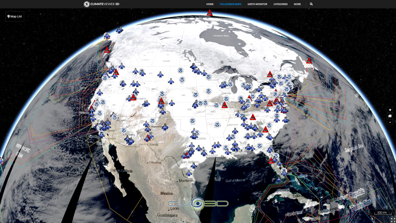
CLIMATEVIEWER 3D

ClimateViewer 3D Fullscreen Globe

REMEMBER TO ALLOW POPUPS ON THIS PAGE

Alerts and Disaster Maps
  • RSOE-EDIS - Radio Distress-Signalling and Infocommunications, Emergency and Disaster Information Service
  • Disaster Alert - Pacific Disaster Center (PDC)
  • GDACS - Global Disaster Alert and Coordination System
  • Global Incident Map
    • Amber-Alert Map (USA)
    • Aviation Incidents (Global)
    • Border Security Map (USA)
    • Disease Outbreaks Map (Global)
    • Drug Interdictions Map (Global)
    • Food and Medical Incident Map (Global)
    • Forest Fires Map (USA)
    • Gang Activity Map (USA)
    • HAZMAT Situations Map (USA)
    • Human Trafficking Map (Global)
  • HealthMap - Disease Outbreaks
  • Fire Map - NASA FIRMS
  • Earthquake Tracking
    • Earthquake 3D
    • IRIS Earthquake Browser
    • IRIS Earthquake Station Monitor
    • National Data Buoy Center
Climate Change
  • Climate Levels Graph
  • The AERONET (AErosol RObotic NETwork)
  • NASA Earth Observatory Global Timelapse Maps
  • Google Earth Engine Timelapses
Flight Tracking
  • ADSB Exchange
  • FlightRadar 24
  • AirNav RadarBox
  • FlightAware Live
Pollution
  • World's Air Pollution: Real-time Air Quality Index
  • Light Pollution Map
  • Noise Pollution Map
Power Plants
  • Power Plant Maps
  • Wiki Solar
Other
  • ResourceWatch | 200+ Maps
  • The Observatory of Economic Complexity (Click Search)
  • Future Danger - Relentlessly Pursuing News for the Prepared
Radio Frequency Monitoring
  • WebSDR, Software-Defined Radio
  • Live VLF Natural Radio
  • VLF Data Viewer
Satellite Imagery
  • NASA EOSDIS Worldview
  • EUMETView - EUMETSAT Monitoring Weather and Climate from Space
  • GOES-16 - College of DuPage
  • GOES-16 Visible (ABI ch 2) - WISC • MP4
  • GOES-16 Infrared (ABI ch 14) AWIPS enh - WISC • MP4
  • GOES-16 Infrared (ABI ch 14) McIDAS enh - WISC • MP4
  • GOES-16 Low-level Water Vapor (ABI ch 10) - WISC • MP4
  • GOES-16 Mid-level Water Vapor (ABI ch 9) - WISC • MP4
  • GOES-16 Upper-level Water Vapor (ABI ch 8) - WISC • MP4
  • NOAA - GOES-East Full Disk View - GeoColor
  • GOES-16 Full Disk (RAMMB/CIRA @ CSU)
  • GOES-17 Full Disk (RAMMB/CIRA @ CSU)
  • Himawari-8 Full Disk (RAMMB/CIRA @ CSU)
  • Joint Polar Satellite System (JPSS) Polar (RAMMB/CIRA @ CSU)
Satellite Tracking
  • Stuff In Space
  • Commercial Space Operations Center (ComSpOC™) Spacebook
  • ESRI Satellite Map
  • AGSatTrack
  • N2YO.com
Ship Tracking
  • MarineTraffic: Global Ship Tracking Intelligence
  • Vessel Finder: AIS Ship Tracking
  • Ship Finder: Live Marine Traffic
  • Ship Locations by SailWX.info
Space Weather
  • Integrated Space Web Application (NASA)
  • Space Weather Prediction Center (NOAA)
  • Helioviewer (Sun Observations)
  • Solarimg - Sun Real Time Data
  • SpaceWeather.com
  • Ionogram Movies for GIRO Locations - University of Maryland
  • Magnetometers | SpaceWeatherLive.com
Weather
  • Zoom Earth
  • Ventusky
  • Wind Map (Nullschool)
  • NOAA nowCOAST
  • Weather Analysis Data - College of DuPage
  • NEXRAD Radar Animation (Stations) - College of DuPage
  • NEXRAD Radar Animation (USA) - UW Madison
  • NEXRAD Radar Animation (USA) - Weather.gov
  • RealEarth™ Data Viewer Map
  • Radar Image Animations - Rutgers Weather Center (USA)
  • Short Range Ensemble Forecast (SREF) - Storm Prediction Center
  • Fleet Numerical Meteorology and Oceanography Center (U.S. Navy)
  • Hurricanes and Tropical Cyclones
    • Joint Typhoon Warning Center (U.S. Navy)
    • Global Tropical Cyclone and Disturbance Information

Sharing is Caring

Jim Lee • Creator of ClimateViewer Maps

I am forever a Boy Scout, lifetime artist, nocturnal programmer, music is my life, love is my religion, and I am the luckiest husband and father on Earth. I speak for the trees. I have a passion for mapping, magnets, and mysteries. Feel free to contact me: jim@climateviewer.com

Leave Us A Comment

NEWSLETTER
Categories
  • Alerts & Weather LIVE
  • Satellites LIVE
  • History & Science
  • Recent
  • Popular
  • HAARP and Ionospheric Heaters Worldwide
    HAARP and Ionospheric Heaters Worldwide
    Sun, May 19, 2024
  • U.S. Rainfall - Multi-Radar/Multi-Sensor (MRMS) System NEXRAD Weather Radar
    U.S. Rainfall - Multi-Radar/Multi-Sensor (MRMS) System NEXRAD Weather Radar
    Sun, May 19, 2024
  • NOAA Watches, Warnings, Advisories, Statements
    NOAA Watches, Warnings, Advisories, Statements
    Wed, May 1, 2024
  • Five Eyes STONEGHOST Surveillance Network
    Five Eyes STONEGHOST Surveillance Network
    Wed, Sep 11, 2019
  • U.S. Measles Outbreaks by County (2012-2019)
    U.S. Measles Outbreaks by County (2012-2019)
    Thu, Sep 5, 2019
  • Radio Telescopes and Space Communications Worldwide
    Radio Telescopes and Space Communications Worldwide
    Sun, Jul 21, 2019
  • Missile Defense Radars (Star Wars SDI, Space Fence)
    Missile Defense Radars (Star Wars SDI, Space Fence)
    Sun, Jul 21, 2019
  • Lasers and Directed-Energy Weapons
    Lasers and Directed-Energy Weapons
    Sat, Jul 20, 2019
  • 50 years of U.N. tracking Weather Modification Projects (1952-1999)
    50 years of U.N. tracking Weather Modification Projects (1952-1999)
    Wed, May 8, 2019
  • Candida auris - the medical facility nightmare
    Candida auris - the medical facility nightmare
    Sat, May 4, 2019
  • 50 years of U.N. tracking Weather Modification Projects (1952-1999)
    50 years of U.N. tracking Weather Modification Projects (1952-1999)
    Wed, May 8, 2019
  • U.S. Rainfall - Multi-Radar/Multi-Sensor (MRMS) System NEXRAD Weather Radar
    U.S. Rainfall - Multi-Radar/Multi-Sensor (MRMS) System NEXRAD Weather Radar
    Sun, May 19, 2024
  • U.S. Rainfall - NEXRAD Radar, Base Reflectivity
    U.S. Rainfall - NEXRAD Radar, Base Reflectivity
    Mon, Jan 1, 2018
  • Missile Defense Radars (Star Wars SDI, Space Fence)
    Missile Defense Radars (Star Wars SDI, Space Fence)
    Sun, Jul 21, 2019
  • 10 Most Radioactive Locations on Earth
    10 Most Radioactive Locations on Earth
    Wed, Apr 25, 2018
  • Geography of the Köppen Climate Classification System
    Geography of the Köppen Climate Classification System
    Fri, Mar 29, 2019
  • The Santa Fe Trail and El Camino Real Trade Routes
    The Santa Fe Trail and El Camino Real Trade Routes
    Mon, Sep 24, 2018
  • The Oregon, California and Mormon Trails
    The Oregon, California and Mormon Trails
    Mon, Sep 24, 2018
  • Five Eyes STONEGHOST Surveillance Network
    Five Eyes STONEGHOST Surveillance Network
    Wed, Sep 11, 2019
  • HAARP and Ionospheric Heaters Worldwide
    HAARP and Ionospheric Heaters Worldwide
    Sun, May 19, 2024
  • Extremely Low Frequency (ELF, ULF, VLF) Transmission Sites
    Extremely Low Frequency (ELF, ULF, VLF) Transmission Sites
    Mon, Jan 1, 0001
  • Lewis and Clark's Expedition - 1804 through 1805
    Lewis and Clark's Expedition - 1804 through 1805
    Mon, Jan 1, 0001
  • MODIS Terra - Corrected Reflectance (Bands 3-6-7)
    MODIS Terra - Corrected Reflectance (Bands 3-6-7)
    Mon, Jan 1, 0001
  • MODIS Terra - Corrected Reflectance (True Color)
    MODIS Terra - Corrected Reflectance (True Color)
    Mon, Jan 1, 0001
  • Map of Environmental Disasters
    Map of Environmental Disasters
    Mon, Jan 1, 0001
  • Submarine (underwater) Telecommunication Cables
    Submarine (underwater) Telecommunication Cables
    Mon, Jan 1, 0001
About Us

ClimateViewer Maps is your source for Earth monitoring featuring an encyclopedic list of exclusive maps resulting in thousands of hours of personal educational bliss not found anywhere else on the internet, let alone in one place.

Get in Touch
ClimateViewer Eye Logo

© Copyright 2011- Jim Lee, ClimateViewer News, LLC.
Sitemap • Terms of Service.

SOCIAL MEDIA

SUPPORT CLIMATEVIEWER

Connect with ClimateViewer and Subscribe

Designed by Rednet Solutions
Powered by Rednet Solutions