
The QPF desk prepares and issues forecasts of accumulating (quantitative) precipitation, heavy rain, heavy snow, and highlights areas with the potential for flash flooding. The basic QPF products are primarily directed to the NWS forecast offices and are available on the Internet for public use. The heavy snow forecast products, in association with the short-range public forecast products (described below), serve as a coordinating mechanism for the NWS winter storm watch and warning program. Through a continuous watch for excessive rainfall, heavy snow, and winter storms, this desk ensures that the highest quality forecast products are constantly available.
The QPF desk is co-located with the National Environmental Satellite Data and Information Service (NESDIS), and together they comprise the National Precipitation Prediction Unit (NPPU). NESDIS meteorologists prepare estimates of rainfall and current trends based on satellite data, and this information is used by the QPF short term forecaster as part of the input for individual 6-hourly forecasts that cover the next 12 hours. With access to WSR-88D/Doppler radar data, satellite estimates, and NCEP model forecast data as well as current weather observations and WPC analyses, the forecaster has the latest data for use in preparation of short-range precipitation forecasts. Meteorological reasoning discussions are regularly written and issued with the forecast packages to explain and support the forecast.
Tags
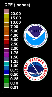
Map Legend
Map Type
Keyhole Markup Language (Google Earth KML)
Map Source
http://www.wpc.ncep.noaa.gov/kml/qpf/QPF24hr_Day1_latest.kml
More Info
http://www.wpc.ncep.noaa.gov/kml/kmlproducts.php
Attribution
NOAA National Weather Service, Weather Prediction Center, HPC Quantitative Precipitation Forecasts (QPFs)Jim Lee • Creator of ClimateViewer Maps

I am forever a Boy Scout, lifetime artist, nocturnal programmer, music is my life, love is my religion, and I am the luckiest husband and father on Earth. I speak for the trees. I have a passion for mapping, magnets, and mysteries. Feel free to contact me: jim@climateviewer.com